


Hymettus topoguide app for iPhone and iPad
Developer: Ubicarta
First release : 09 Mar 2018
App size: 29 Mb
Mt. Hymettus topoguide is a digital field guide for hikers, bikers and nature lovers.
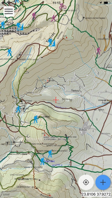
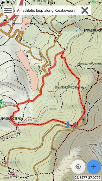
It includes routes, descriptions and photos for 29 hiking and mountaineering trails, 12 mountain bike (MTB) rides and 4 mountain running trails, which spread throughout the Mt. Hymettus, near Athens, Attica, Greece.
These 45 Adventure cover the whole Mt. Hymettus mountain range (the mountain is also known as Imittos or Hemyttos).
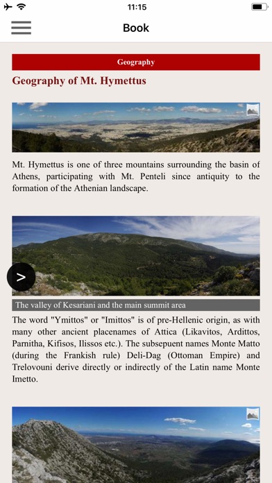
The application offers detailed offline maps and an extensive introduction on geography, geology and the nature of Mt. Hymettus, as well as a useful list of POIs.
The trails list includes easy walks, easy and moderate hiking trails and long mountain traverses, of a total length of 160 km.
The MTB routes, designed with the help of the cyclist Vangelis Kenourgios, cover all levels of difficulty and sum a total length of 198 km.
The cartographic company AnaDigit, creator of the application, has issued previously detailed hiking maps at a scale of 1: 10,000 for Mt. Hymettus, as well as hundreds other hiking maps for Greece (eg. maps of Crete, Zagori, Sifnos, Naxos and other Aegean islands). To build the application and ensuring data accuracy, all tracks of Mt. Hymettus have been recorded again during 2015.
DISCLAIMER
During track recording, continued use of GPS can dramatically decrease battery life.